13
JulGeographia of Uzbekistan.
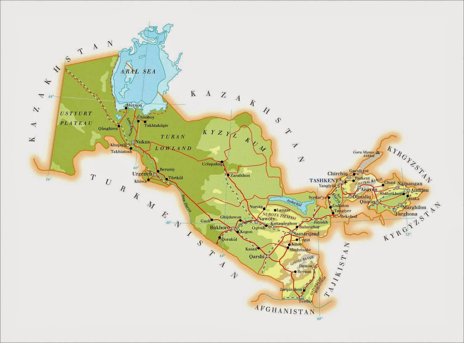
Geographical Overview Uzbekistan is one of the largest countries in Central Asia. It occupies a central position in Central Asia. Our country is located between two major rivers, the Amu Darya and the Syr Darya. Its population is nearly 32,121,100 (2017). It is one of the fifteen former republics of the USSR. Uzbekistan has been an independent state since August 31, 1991. It is located at the following coordinates: 41° North latitude, 64° East longitude. Its area is 448,900 km2. It stretches 1,425 km from west to east and 930 km from north to south. Its time zone is UTC+5. It occupies the 56th place in the world by area. 70% of Uzbekistan's land area is desert, while 10% is rivers. The country has no coastline. Uzbekistan is landlocked. It borders five states: Kazakhstan (to the north and west), Turkmenistan and Afghanistan (to the west and south), Tajikistan (to the east), and Kyrgyzstan (to the northeast). The Republic of Karakalpakstan is a constituent part of Uzbekistan. The total length of Uzbekistan's borders is 6,221 km: 137 km with Afghanistan, 2,203 km with Kazakhstan, 1,099 km with Kyrgyzstan, 1,161 km with Tajikistan, and 1,621 km with Turkmenistan. Uzbekistan has 420 km of coastline on the Aral Sea. The highest point is 4,643 m (Khazrat Sultan). Distance from France: approximately 6,000 km. The time difference is +4 hours in winter and +3 hours in summer.
Geographical Overview Uzbekistan is one of the largest countries in Central Asia. It occupies a central position in Central Asia. Our country is located between two major rivers, the Amu Darya and the Syr Darya. Its population is nearly 32,121,100 (2017). It is one of the fifteen former republics of the USSR. Uzbekistan has been an independent state since August 31, 1991. It is located at the following coordinates: 41° North latitude, 64° East longitude. Its area is 448,900 km2. It stretches 1,425 km from west to east and 930 km from north to south. Its time zone is UTC+5. It occupies the 56th place in the world by area. 70% of Uzbekistan's land area is desert, while 10% is rivers. The country has no coastline. Uzbekistan is landlocked. It borders five states: Kazakhstan (to the north and west), Turkmenistan and Afghanistan (to the west and south), Tajikistan (to the east), and Kyrgyzstan (to the northeast). The Republic of Karakalpakstan is a constituent part of Uzbekistan. The total length of Uzbekistan's borders is 6,221 km: 137 km with Afghanistan, 2,203 km with Kazakhstan, 1,099 km with Kyrgyzstan, 1,161 km with Tajikistan, and 1,621 km with Turkmenistan. Uzbekistan has 420 km of coastline on the Aral Sea. The highest point is 4,643 m (Khazrat Sultan). Distance from France: approximately 6,000 km. The time difference is +4 hours in winter and +3 hours in summer.
Comments
Please log in to post a comment.